Alibi Admin Dashboard
Alibi Admin Dashboard
The project began with the need for a single unified platform to coordinate teams and drones during humanitarian operations such as flood relief and post-earthquake surveys. Stakeholder workshops were conducted with operators, mission planners, and compliance officers.
Category
Web Design
Client
Customerx
Start Date
August 12, 2025
Developer
MD Jwel Rana
Project Description
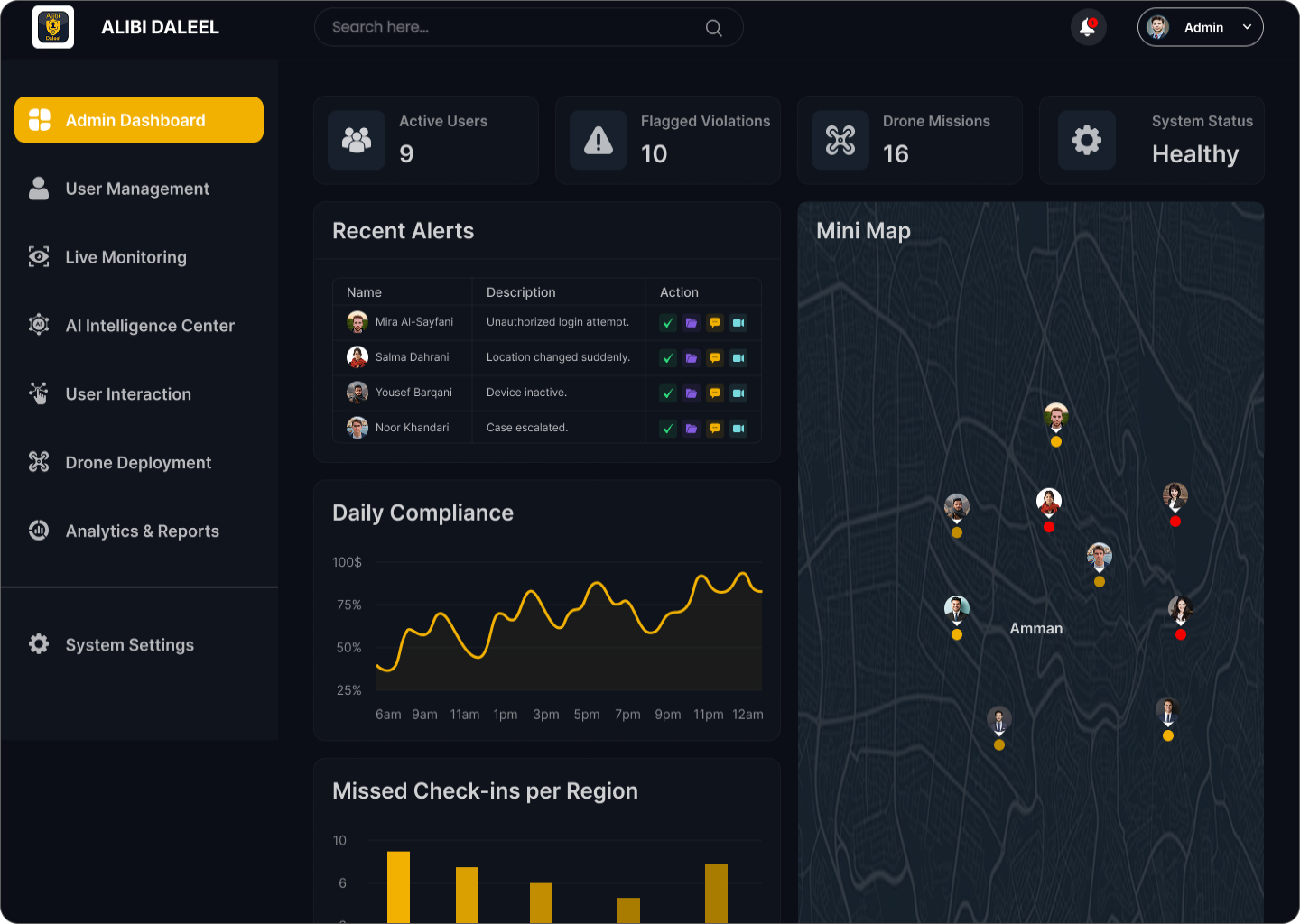
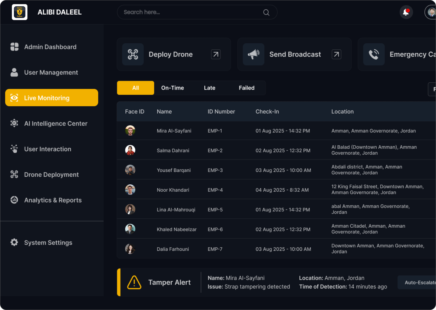
Alibi Admin Dashboard is a secure and reliable operations platform designed to give authorized teams real-time situational awareness over assets, locations, and unmanned systems for non-lethal, humanitarian, and defensive missions such as disaster response, survey missions, logistics coordination, and perimeter monitoring.
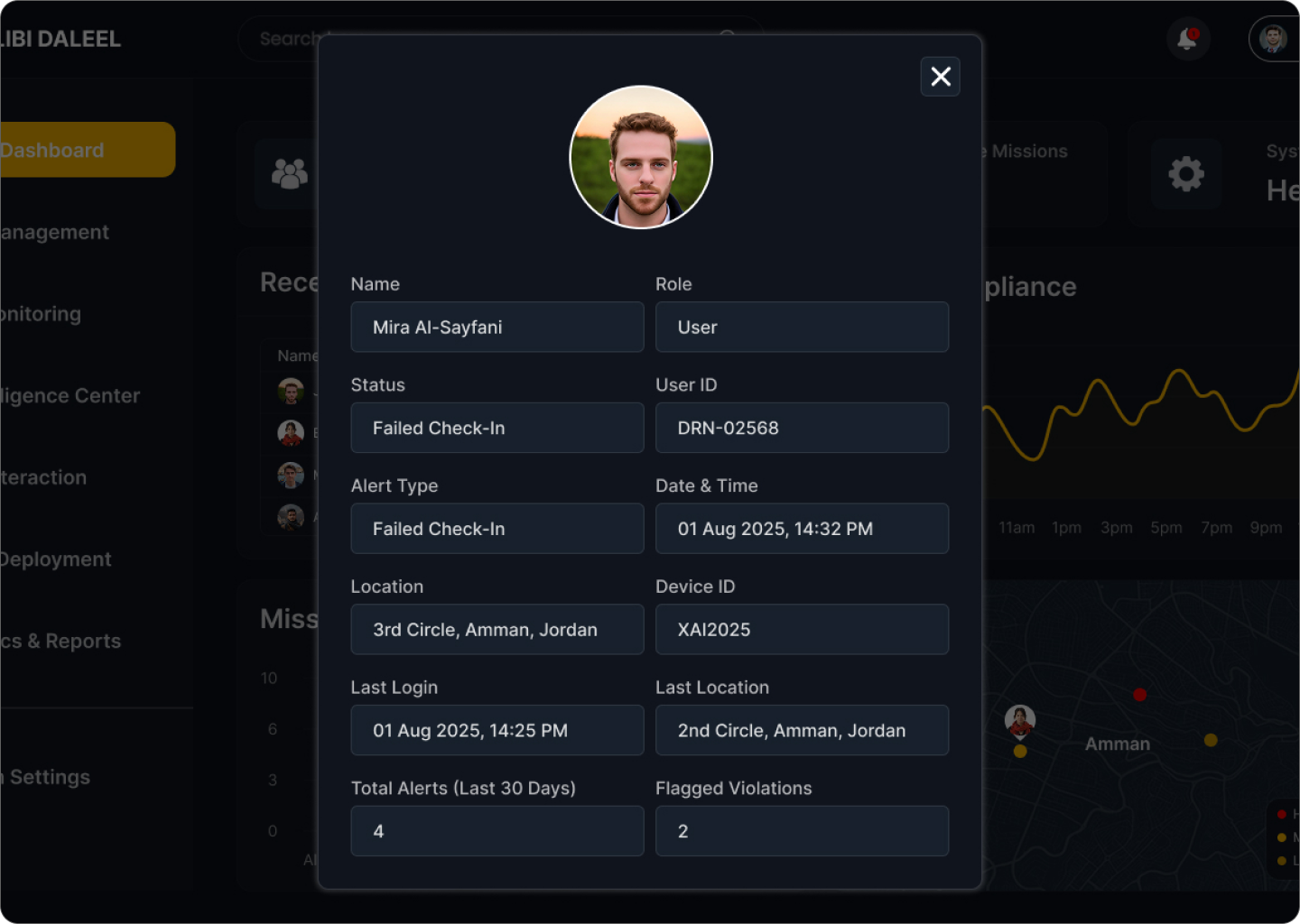
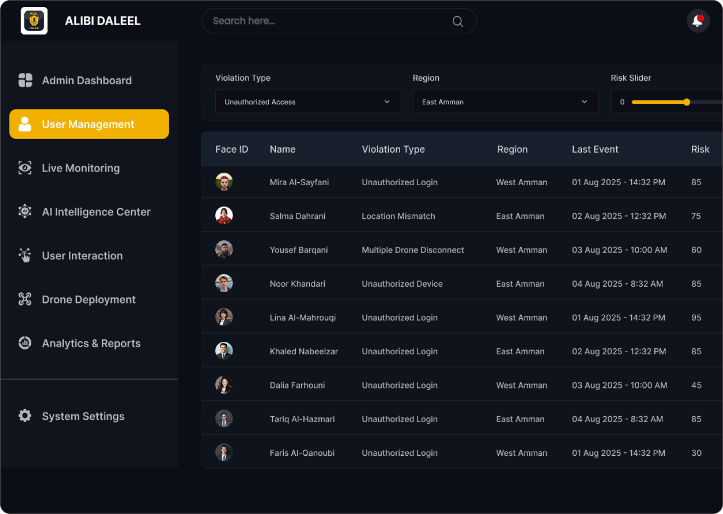
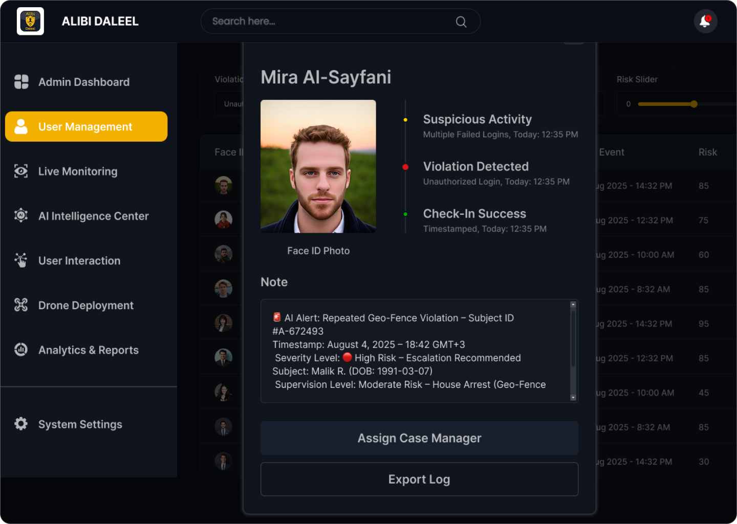
The dashboard consolidates live telemetry, geospatial data, and secure video feeds into a single, intuitive interface. It enables operators to make faster and smarter decisions while ensuring role-based access, full audit logging, and privacy-first safeguards.
At its core, the dashboard is map-centric: operators can track units on a dynamic map, plan missions on an interactive timeline, monitor live telemetry through structured panels, and respond quickly to alerts. Every action is logged and verified with safeguards to prevent misuse.
Demo Access:
Clients can experience the dashboard in demo mode without needing special credentials. To log in, simply use any email address and any password. The demo environment is completely simulated and read-only — meaning no real units or drones are controlled. All actions are logged, and demo data is kept in a secure sandbox, fully separated from production systems.
THE STORY
The project began with the need for a single unified platform to coordinate teams and drones during humanitarian operations such as flood relief and post-earthquake surveys. Stakeholder workshops were conducted with operators, mission planners, and compliance officers.
Early prototypes revealed that operators were overwhelmed by raw telemetry streams — they needed contextual, prioritized data instead of raw numbers. Privacy also became a recurring concern, as video and geolocation data in public areas had to be carefully managed.
The system was built iteratively: starting with a lightweight map-first prototype for tabletop simulations, later validated in controlled field tests using non-weaponized drones for mapping and supply drops. Each round added more features — offline resilience, role-based separation, and robust auditability.
The final dashboard strikes a balance between rich operational capability and security-first, compliance-friendly design, ensuring teams can respond quickly and responsibly without risking misuse.
MY APPROACH
My approach began with a deep research and discovery phase, where I engaged with field operators and mission planners to understand their workflows and critical needs. From there, I defined a clear information architecture that prioritized time-sensitive data and organized the dashboard into logical zones such as the map, timeline, telemetry, and alerts. I then created wireframes and high-fidelity prototypes, iterating based on feedback from stakeholders and usability testing under simulated mission scenarios. Security and privacy were central to the design, with features like role-based access control, audit logging, and encryption baked into the user experience. To allow safe exploration, I developed a sandboxed demo environment where clients can log in using any email and password, with read-only access to simulated data. Finally, I ensured smooth collaboration with the engineering team by delivering design tokens, specifications, and accessibility guidelines, and I continued to refine the solution through post-launch feedback and monitoring.